Probably the best scenic walk near Grange-over-Sands (4.9 miles)
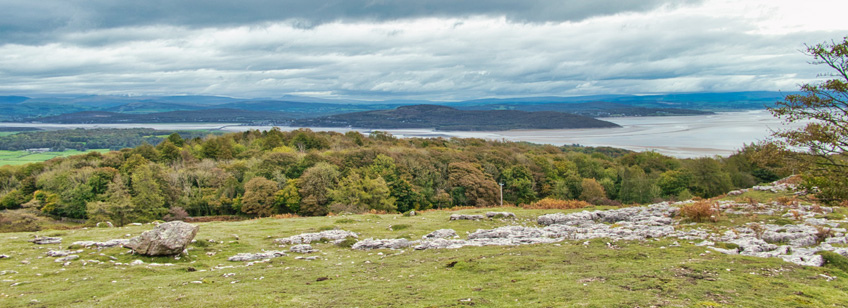
Sitting on the picturesque coast of the Lake District's Cartmel Peninsula, and enjoying an exceptionally mild climate thanks to the warm waters of the Gulf Stream, Grange-over-Sands is blessed with fabulous views of Morecambe Bay and its surrounding coastal countryside. But even if you are lucky enough to live in one of Grange's many homes with a panoramic view of the Bay, nothing quite compares to the stunning 360° vistas afforded by a quick trip up to Hampsfell Hospice and beyond.
The hospice sits atop a fell (an old Norse word for 'mountain') that was once known as Hampsfield Fell (now shortened to Hampsfell), comprised of sedimentary limestone bedrock formed during the Carboniferous Period i.e. many big lots of years ago when vegetarians and sea-food lovers would have been in their element.
During the Act of Enclosure that followed a few years later, in 1796-1803, when the common man was robbed blind of his right to roam and graze livestock, the area was divided into Hampsfield Allotment, Bishop’s or Tithe Allotment, Longlands Allotment and Straight Allotment (plus a few others), the names of nearly all of which can still be seen on current OS maps. Most people that walk to the hospice go no further, but the very best views to be found in every direction, can be experienced by extending one's route to incorporate the entire environs of the original Hampsfield Fell, metaphorically sticking two fingers up at Sir Thomas Tyrwhitt and his fellow Eton-educated MPs that lived during the late 1700's. This is what we are going to do today, although sticking two fingers up is not mandatory.
Let me begin by pointing out that the small photos on this web-page cannot possibly hope to capture the beauty of what we see through the 3D vision gifted to us by nature. Even less so given that most of these photos were taken on an overcast autumnal day. Don't for a second think that these images are representative of what this walk has in store for you.
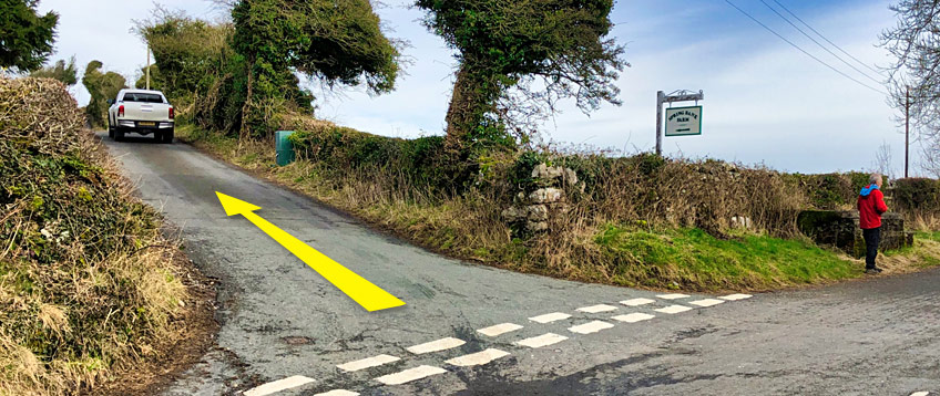
We start our walk at the intersection of Grange Fell Road and Spring Bank Road, as shown in the photo above (taken last winter). There are a few roadside areas nearby where you can leave a vehicle, including one right opposite this junction, and more by Grange Fell Cemetery down the road. Outside of the tourist season it is not too difficult to find a parking spot, but on a clear day in the height of summer, you might need to park-up in town and extend your route a little. However, the main car parks in town are less than a mile away, so this shouldn't be a major issue.
Start by walking north up Spring Bank Road. Just past the white truck shown above, you will see a stone-step stile on your left, which you should cross. If the white van has moved on by the time you visit, you'll just have to use your imagination.
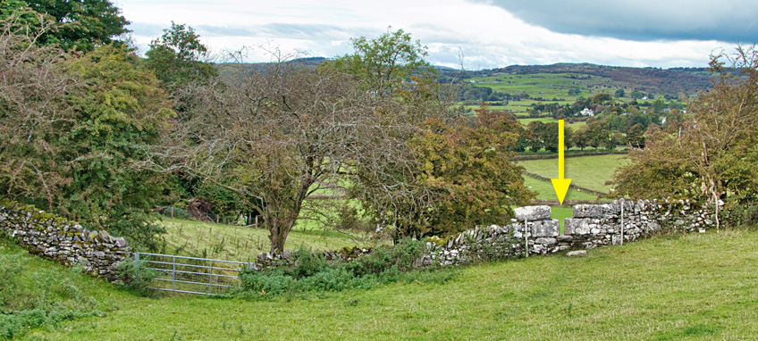
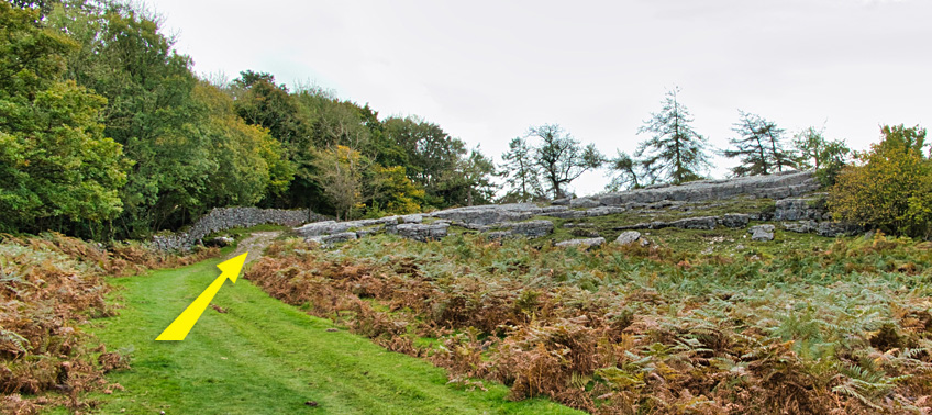
Bear right and follow the line of the boundary wall uphill as shown below. "...Hey, wait for me while I take this photo for my blog!"
After a short climb you will come to a corner in the boundary wall as it skirts around a water facility. Do not turn right here, but keep going upwards in the same direction, as shown below.
Keep following the established path up and gradually round to your left, through a large gap in the tree-line. Do not turn right at any point, just follow the path all the way to a large gate in the dry-stone wall that is on your right as you approach it. Go through the gate, unless it is closed, in which case there are some stone steps set into the wall just past the gate.
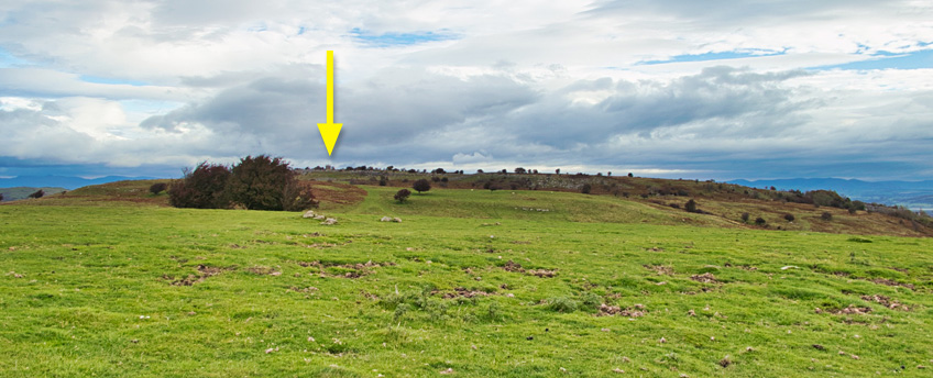
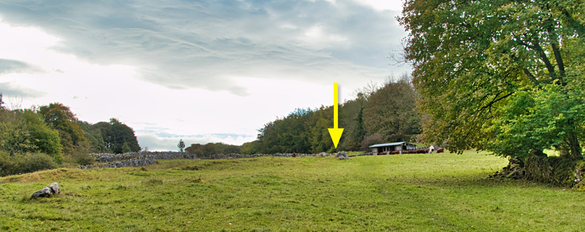
The path you are now on is wide and well used. It doesn't matter if you deviate left or right at the fork just past the gate, as long as you keep going in a general north-north-easterly direction towards the top of the main fell. If you take the right fork, you will soon see the scene below, and although the large square tower of Hampsfell Hospice looks as tiny as a very small thing in this photo, you can't really miss it in reality. If you took the left fork, the hospice will be just to the left of the trees. Either way, just keep going uphill until you find yourself at the base of the tower.
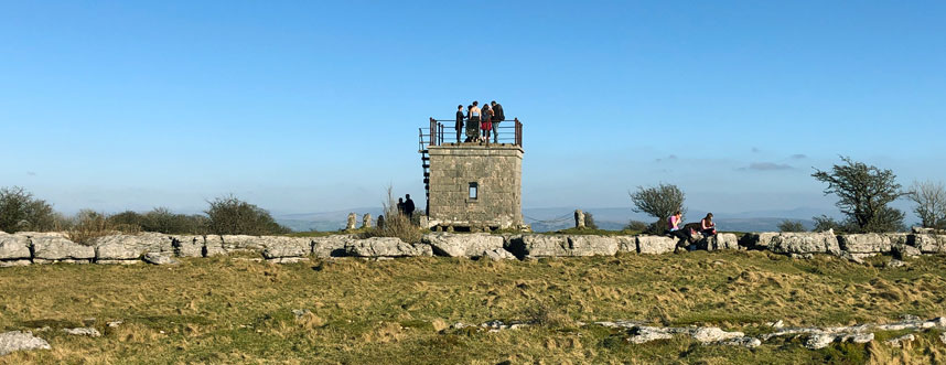
Built in 1846 by the vicar of Cartmel, the Reverend Thomas Remington, Hampsfell Hospice has provided shelter for travellers ever since. Inside there are stone benches and painted boards commemorating its construction, praising the views and welcoming visitors. On the north side of the tower are stone steps leading to the roof, which offers a 360° panoramic view of Morecambe Bay, much of the rest of the Lake District National Park (which you are now standing in), The Old Man of Coniston, Arnside Knott, the Kent Estuary and much more beyond. Hampsfell is the subject of a whole chapter of Alfred Wainwright's popular book: The Outlying Fells of Lakeland.
Once you have taken in the sights that those extra few meters above the tree tops afford you, resume your walk in roughly the same direction that you were heading when you arrived i.e. northwards, as shown below. Don't get too worried about making the most of the views though, for your walk today encompasses all the sights you can see from the tower, and then some! So much so that you probably won't feel the need to revisit the tower on the return leg.
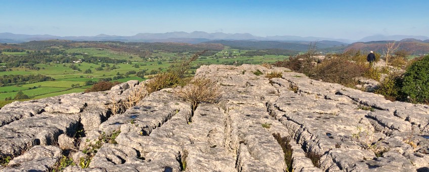
When you come to the tall edge of a limestone pavement (the wall of stone shown above), follow the path left and then immediately right again, keeping close to the pavement (as shown below).
Alternatively, if you are reasonably agile, instead of turning left at the limestone escarpment shown two pictures above, climb up onto it as it is quite a sight in its entirety (a very small section of which is shown below). The limestone pavement hosts many wild flowers in the spring and was formed from the fossilised remains of shells and corals around 340 million years ago in the warm shallow sea that covered much of north-west Europe at that time.
Roughly 12,000 years ago, give or take a few months and depending on which geologists you speak to, glaciers scoured the rock and as the ice sheets retreated, the meltwaters dissolved the surface leaving the distinctive patterns that are now known as limestone pavement. Take care with your footing and do not take anything out of your pockets when standing on the pavement, as many of the gaps you can see below extend downwards much further than you can reach!
If you do climb up to take a look, walk over to where you can see the figure of a chap named Mick in the picture below, for that is the edge of the pavement seen in the photo above, which allows you to rejoin the path without the need for climbing ropes and carabinas.
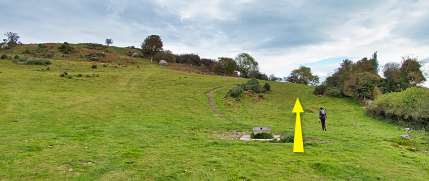
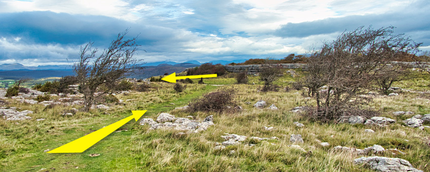
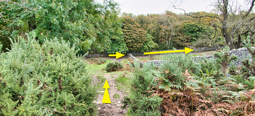
Not far after the scene shown two pictures above, the main path bends round to the right, but instead of taking that route to hell and damnation and all other terrible things to be found 'off route' ("...there be dragons in them there hills"), take the smaller path out to the left (due north), which leads you to safety, Godliness and the scene below.
Shown under the large yellow arrow which will probably have blown away by the time you read this, is a kissing gate. Yes; you guessed it right; that is where we need to get to next, although the kissing is not mandatory (but don't tell my other half as these are the highlights of our walks).
Once through the gate and a few shrubs, keep following the path in the same direction due north, between the two stone dwarf-pillars shown below.
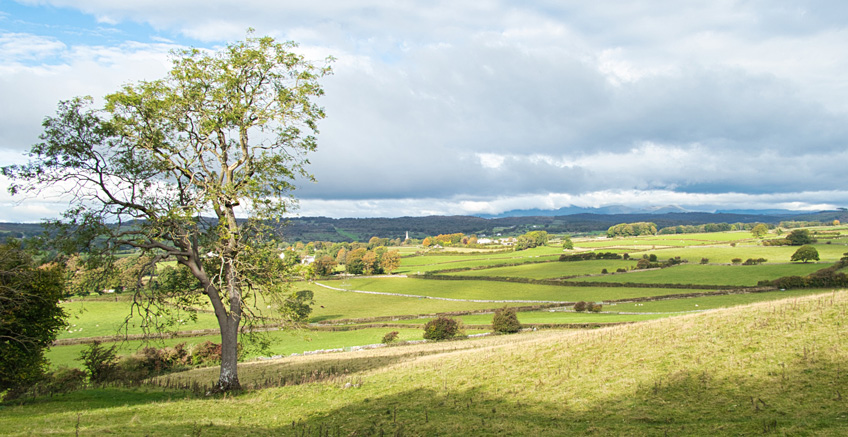
The path drops downwards and eventually leads through trees and shrubs to a couple of gates. The wooden gate down and round the corner to your left is the one you want, as you have no right to use the larger one up on the right! Turn right once through the wooden gate, and walk uphill. We will soon be entering the field on your immediate right, but not just now as this is not where the footpath runs. Instead, walk on a little until you can see the church spire shown below, on your left.
If you regularly work-out at the gym, you might want to have a go at opening the gate in the dip to your right. Alternatively, you can save your hernia surgeon some work by using the squeeze stile a little further on than the gate. It's hidden up and behind a tree limb so you won't see it at first, but as you've been diligent enough to read this article before you set out, you now know what your current location looks like from the other side of the wall ...behold; a squeeze stile for your delectation, amusement, and/or whatever else you want to do in the middle of Ruralshire!
Follow the right-hand boundary of the next field uphill, until you see a short wall perpendicular (a sticky-out bit) to the main boundary line (wall). Set deep into the corner is a stone-step stile, which is the correct way to enter the land of our friend 'Farmer Bill', one of life's lovely people, and a person who was pivotal in our decision to move to Grange-over-Sands earlier this year.
Once through the stile, keep dogs on a lead (if applicable) and follow the path uphill to the east-west, past a stone structure that Farmer Bill reliably informs me is, or was, a lime kiln. From Roman times onwards, lime has been burnt to produce quick lime (calcium oxide), and then mixed with water to produce slaked lime (calcium hydroxide), both of which were once used as a fertiliser, and also as a mortar and putty for buildings.
Carry on uphill to the gate shown by the yellow arrow below (the right of two gates on the far side of the field), which is just past some wooden livestock sheds. You may be greeted by an inquisitive horse or two, or a herd of beefs, but worry not as they are used to walkers passing through.
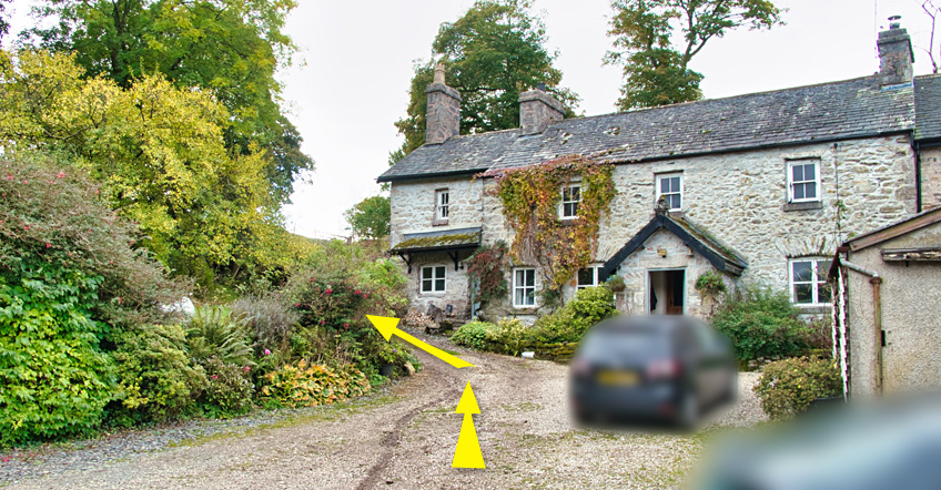
Go through the gate and down another path to and between two rows of out-buildings belonging to High Hampsfield Farm, after which you will see a farmhouse on your right (shown below).
Please respect the fact that although you have every right to use the footpath you are currently standing on, you are on someone's driveway, about to pass a few feet away from their home. Please be quiet and move on swiftly or I will have to recommend that Bill trades in one of his lovely working dogs for a Rottweiler. Or a little yappy thing that drives people up the wall when they're not zipped-up inside a large handbag or rucksack!
Walk quietly past the farm house as shown above, through a big gate and follow the well-worn path uphill to the south. As the path then levels and heads downhill (as shown below), note that you need to turn right and go through the gate at the very bottom of the land, into Bishop's or Tithe Allotment.
Follow the boundary wall (Merlewood and Eggerslack Wood are on the other side) south-ish until you see the limestone pavement wall that looks something like this (below). When I say 'something like this', I mean 'exactly like this' but with an allowance for seasonal flora variations and weather.
A very short distance past this rise in the path, is a footpath sign-post on your left, pointing to, among other nearby locations, Hampsfell Hospice. Take this path to the right, but we are then going to bear left as we climb, as Hampsfell Hospice is now "so last year, Darling" to our recently expanded outlook on all things Hampsfield Fell.
As you approach the mini-cliff pavement edge at the top of the fell, bear left in front of it and climb the pavement at a very obviously well-used point to the left of the main edge-line, heading further upwards in a south-westerly direction. Don't forget to look behind as you climb the fell, because into view (shown below) will gradually come Arnside, Silverdale, and the aptly named Arnside & Silverdale Area of Outstanding Natural Beauty, topped by the prominent big lumpy thing on top known as Arnside Knott...
Near the top of the hill that you should now be climbing in a south-westerly direction, tracking in from your left, is a standard Cumbrian dry-stone wall that you need to cross. Look carefully for a four-foot post with a way-marker on it, close to the wall. As you get nearer to it, you should see the stones of a stone-step stile which will enable you to get to the other side without the need for a pole-vaulting pole. If you have just carted a pole-vaulting pole with you for the last three miles because you didn't know about the steps, more fool you for not reading these notes before you left home!
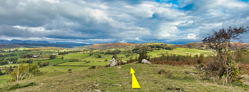
Once over the wall, carry on heading south-west along any path (or not) that looks like it goes in the right direction i.e. south-west. The footpath shown on the OS map does not match-up with any path exactly, but even though you are currently on private land, the whole Longlands Allotment appears to be treated by the owners as if it were open land. Ignore the hospice on your right and head for where the limestone pavement edge meets the wall ahead of you. Just downhill to the right from this is another set of stone steps, which you should now cross (shown below).
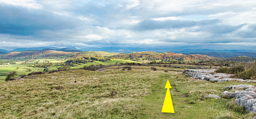
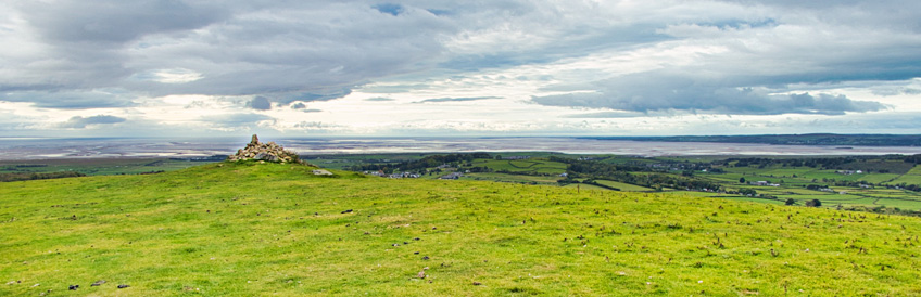
Head south-west on the minor path ahead of you, until it intersects with the major path that you took on your journey to the hospice an hour or so ago (which can be seen above). Keep going, back-tracking all the way to the big gate with the stone-steps that are now just to the right of the gate. Go through the gate or over the wall, but instead of back-tracking down to your left, head uphill to the south-south-west until you see the cairn shown below, that marks the top of Fell End. I've been trying for years to find out how it got this name, but the answer continues to allude me.
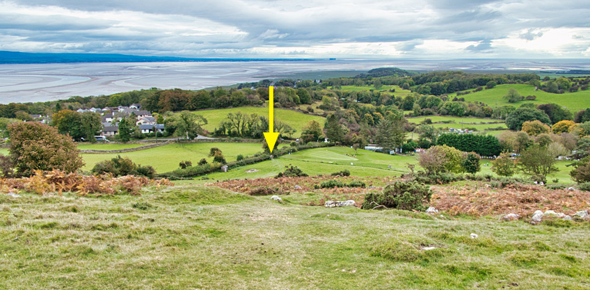
Soak-up the views of the entire Cartmel Peninsula coastline. And if you are wondering why there's a lighthouse halfway up the hill on the opposite side of the Cartmel Sands above Ulverston, it is actually a 100ft scale replica of an early Eddystone Lighthouse, erected in 1850 to commemorate Sir John Barrow, a founder member of the Royal Geographic Society, who was born in Ulverston.
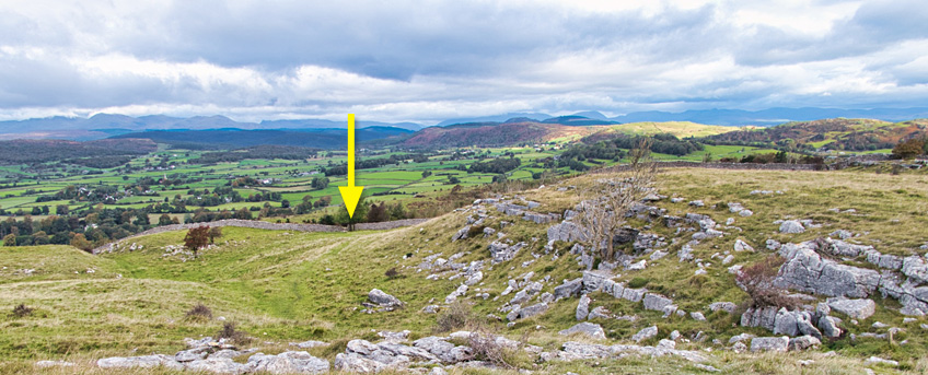
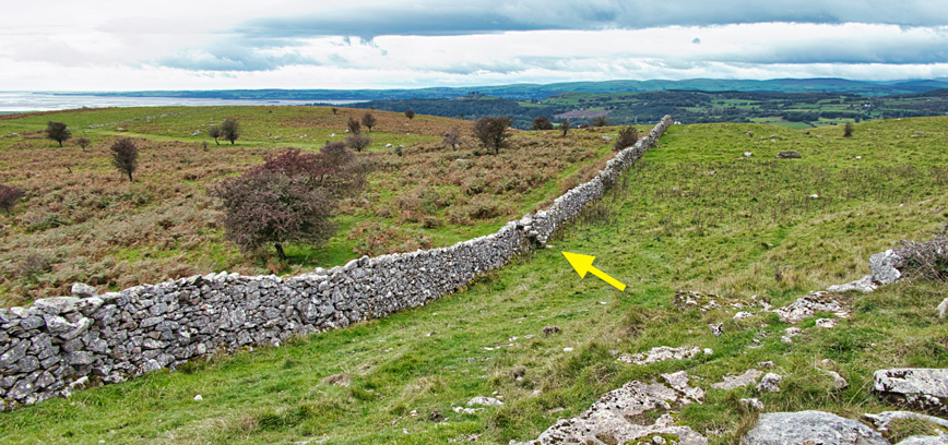
So now it's downhill all the way back to the car. Look to the south-east and you will see a small collection of rocks and trees - head just to the right of them until you see this scene before you...
...then head downhill to the stone-steps in the corner by the golf course tee-off point, marked by the yellow arrow above. Go over the wall, turn right, and walk down to the road junction that you started from.
Was it worth it? Did you enjoy it? If so, please let me know by submitting a comment below.

")