Walks near Grange-over-Sands - Grange to Cartmel to Fell End (circular, 7.5 miles)

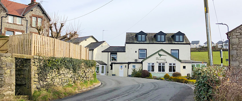
Being circular, this walk can start and finish from any point on the route, but as, at the time of writing, the author lives near the Pheasant Inn in South Allithwaite, that is where this write-up will begin.
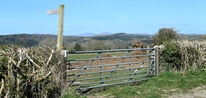
Walk north up the narrow B5277 into Allithwaite, turning left onto Vicarage Lane just past the post office. Continue past the church on your right, past the new Russel Armour houses, onto and down Boarbank Lane to the junction with Looker Lane. Follow the road round to the right, as if you were walking to Cartmel, until you see this footpath marker on your left...
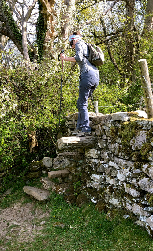
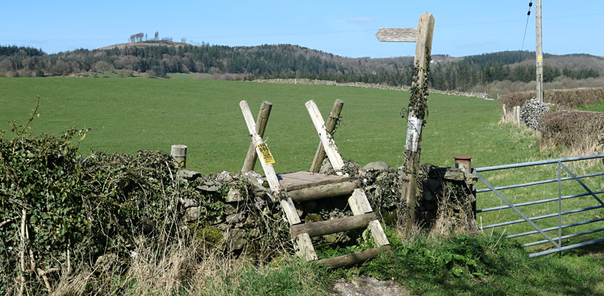
In typical Lake District fashion, the footpath uses a stone-stile over a wall with a steep drop on the other side (shown right). The stone steps are relatively large, but the combination of the high wall and the steep drop on the other side make for a descent that elderly or infirm walkers might find a little challenging.
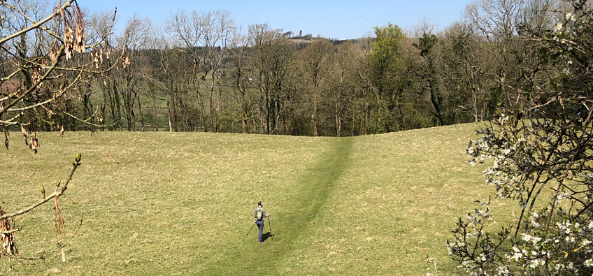
Once over the wall, head slight-right to the dip in the field shown in the image below. Whilst the path might look obvious in this springtime photo, things might look different at other times of the year. If, indeed, you walk this route in the spring, you will be able to find your way with your eyes closed and your nostrils open, for on the other side of the hill is a gap in the wall leading to a short path that is surrounded by wild garlic which assaults one's senses!
Walk past the garlic, left alongside a high fence, right alongside a low barn, then through a courtyard and right onto the Birkby Hall driveway. Follow this to the Cartmel Road and look right where you will see a step-stile that you should traverse.
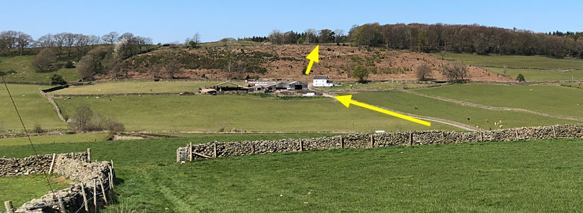
As you follow the footpath down the field, you will eventually come to a wide gap in the end-wall, from where you will be able to see the next few stages of your walk (see image below). Once through the gap, turn immediate right and follow the perimeter of the field down to the far-right corner where you exit through a squeeze-stile onto the Holker-to-Cartmel Road. Almost opposite you now should be the entrance road to Low Bank Side Farm, which you can take (see lowest yellow arrow below) across the River Eea. Walk to and directly through the farmyard, upwards and through a noisy gate with a heavy metal latch. Almost opposite you now, over to the left, is a wooden gate that you should go through, which leads onto a zig-zag path up the shrubland to yet another stone-stile and gate (see highest yellow arrow below).
Once through the gate follow the well-trodden path through the majestic woods to a squeeze-stile hidden in the corner of the walls, then down to what we like to call 'Pine Point' for what should be obvious reasons. Turn immediately right and follow the tarmacked lane past High Side Bank (note the beautiful views to your right) and through Lane Park which seems to be ever-popular with families out for a weekend stroll. At the end of the path through Lane Park, you will come to a cross-roads of paths which we like to call 'Cartmell Cross'. Keep walking straight ahead...
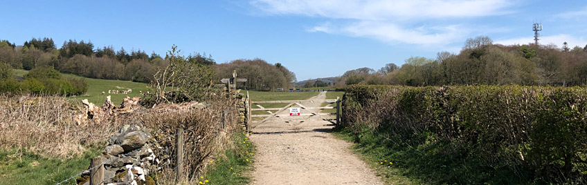
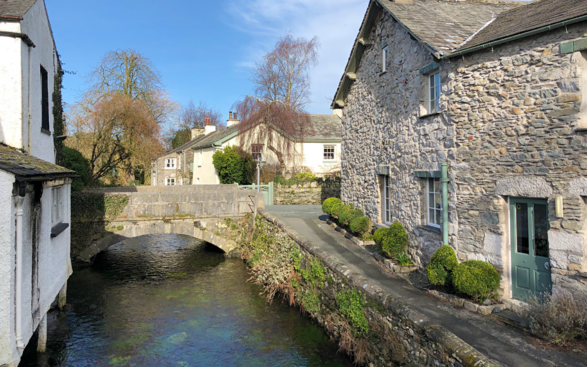
At the other side of the field and path shown above, is the Cartmell Park and Racecourse, which you will now need to cross. If you happen to be attempting this walk on one of the few days of the year when the racecourse is holding an event, you may need to detour round the track instead of through it - the clue to your next move will be the sound of crowds, running commentary over speakers and dozens of charging horses ...or not! If it's the 'not' option, follow the paths into Cartmel village and stop, if you wish, for tea, crumpets, beer, whatever. Cartmel is the quintessential English village so have your camera ready to take those 'chocolate box' pictures.
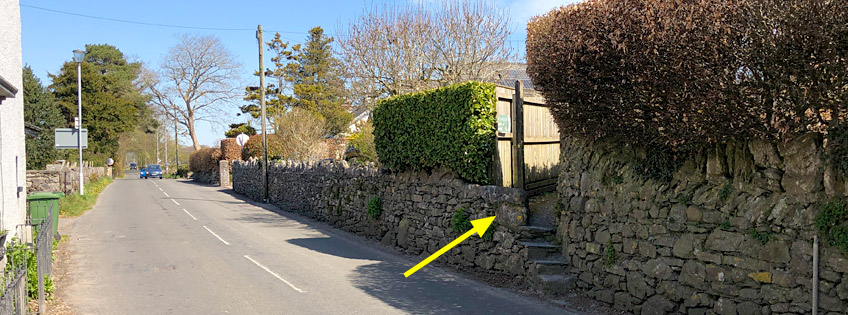
Once you have torn yourself away from the sleepy village setting, head down to the church, through the main gate, and round to the far-left rear gate. Turn right down Priest Lane, then left onto the main road to High Newton. Don't walk too far though, for within a dozen yards is a set of steps shown below, that you need to take.
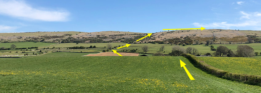
The sign declares this as the Cartmel to Hampsfell footpath, and as you step out into a field, a notice leaves you in no doubt about the Pit Farm owner's feelings towards dogs being kept on leads! At this point you should stop and survey the next stages of your route which are shown below. Psych yourself up for a climb, because that gentle hill in the distance feels a lot less gentle once you're half-way up it! If ever you are going to follow a footpath rigidly, this is probably the time to do it. Follow the hedgerow over the rise and down alongside a race-horse training area. Signs clearly mark the footpath course through the farmyard so follow them onto a driveway and then right, alongside a cattle shed as you emerge onto the dry field shown in the centre of the image below. The footpath runs across the middle of the field tracking slightly left to a gate on the far side (shown below).
Go through the gate and keep left as you climb uphill to the open land beyond. From here you can walk in any direction as indicated by the brown shading marking the perimeter of the open land on the OS map. However, keep climbing the path upwards in front of you, which passes just to the right of the wooden power pylon that should be visible among the trees further up. Don't forget to stop and look behind you on the climb upwards, for the views are, well, see for yourself...
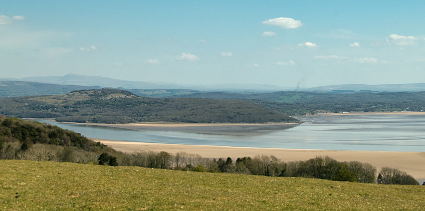
As you emerge from the scrubland, the grassland opens up before you but keep following the same path until you come to a crossroads at the very top. Turn right and follow the new path downhill, across a stone-stile and then upwards to the cairn that marks the location known as Fell End. Behold: yet more stunning views, this time of the Kent Estuary and Arnside beyond, and Morecambe Bay with Morecambe in the distance. If today is a clear day, you'll want to stay here for hours, lapping up the stunning views...
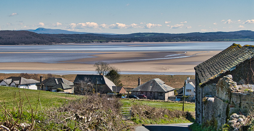
Once you are ready to continue, head down the fell in a south, then south-easterly direction to the bottom-left corner of the field, and over a stone-stile onto Spring Bank Road. Follow it down to Grange Fell Road, then turn right but look for a footpath sign on your left after a few dozen yards. Take this footpath alongside the allotments through what feels like an enchanted wood, round a huge fallen tree and then back onto a narrow path down to Cartmell Road. Turn left and follow this lane all the way into Grange-over-Sands. As with much of this walk, even this innocuous minor highway has a stunning view waiting for you near its end...
Once onto the B5277 Allithwaite Road, head uphill to the right, past the 'can't miss it' Cartmel Grange Care Home originally built in 1914 as a convalescence home for miners, with its bowling green and a grade II listed war memorial. Keep following the Allithwaite Road out of Grange-over-Sands and into Allithwaite, but just before the road bends downhill to the right, track straight ahead onto and down the narrow Jack Hill with yet more views, but this time across the Leven Estuary with Ulverston beyond.
At the bottom of jack Hill is the Pheasant Inn and the completion of today's walk. If you've enjoyed it, please let me know what you think of it in the comments section below.

")